
ABOUT US
Our Services
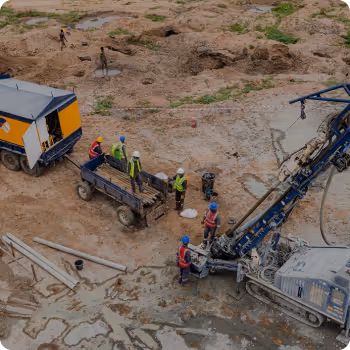
Drilling & Resource Definition
Projects
Policies
Downloads
 Contact Us
Thank you! Your submission has been received!
Oops! Something went wrong while submitting the form.
Contact UsAs a leading Mineral exploration company, Titan Minerals Limited have a thorough understanding of the JORC code and its associated mechanisms and can assure that with our modern exploration techniques your reports will form a primary showcase of your project to investment audience and regulatory bodies. We ensure that technical information is presented in the most accountable way possible.
Contact UsIn Nigeria, a country rich in untapped mineral resources, modern exploration techniques like airborne geophysics and remote sensing are playing a pivotal role in identifying and unlocking the mineral potential of regions that have been historically underexplored. With an access to a very wide range of data sets and decades of experience in Nigerian geology, at Titan Minerals, we employ these advanced technologies as part of our comprehensive exploration strategy to accurately identify high-potential mineral deposits and reduce the inherent risks of exploration.
Airborne geophysical surveys involve the use of aircraft equipped with various sensors that measure physical properties of the Earth's surface and subsurface. These surveys are a highly efficient and effective way of covering large and inaccessible areas, particularly in Nigeria’s diverse and often remote terrains.
Magnetic Surveys & Radiometric Surveys
Electromagnetic (EM) Surveys
At Titan Minerals, we leverage advanced remote sensing technologies—such as satellite imagery and aerial photography—to complement airborne geophysics. These tools provide high-resolution, multispectral data that reveal surface features, vegetation patterns, and geological formations. By analyzing this data, we can identify indicators of mineralization and structural trends linked to underlying mineral deposits.
Satellite Imagery
LIDAR (Light Detection and Ranging)
Thermal Infrared Imaging
By integrating remote sensing with airborne geophysics, we deliver a more complete and accurate view of Nigeria’s mineral landscape.
Identify and prioritize exploration targets
Lower exploration risk
Support informed, data-driven decision-making
At Titan Minerals, we believe that the integration of airborne geophysics and remote sensing is a game-changing approach in unlocking Nigeria's vast mineral wealth. With the ability to rapidly and cost-effectively assess large areas, we are confident in our ability to discover new mineral resources and contribute to the sustainable development of Nigeria's mining industry.

Ground geophysical surveys in mineral exploration involve a variety of techniques used to investigate the subsurface and detect mineral deposits. Unlike airborne surveys, ground-based methods are conducted directly on the surface and provide more detailed, localized data about the geological features below.
Magnetic Surveys
Electromagnetic (EM) Surveys
Resistivity and Induced Polarization (IP)
Gravity Surveys
Ground geophysical surveys provide high-resolution data that are essential for guiding drilling programs, understanding the geologic framework, and reducing exploration risk. These surveys can be customized to target specific mineral deposits, improving the efficiency and cost-effectiveness of exploration programs.
In the dynamic field of mineral exploration, geological mapping, geochemical sampling, and Trenching are integral methods that provide the foundation for identifying and assessing mineral deposits. These techniques are crucial for understanding the subsurface geology and mineralization processes, especially in countries like Nigeria, where vast untapped mineral resources are waiting to be discovered.
At Titan Minerals, we employ these methods as part of a comprehensive exploration strategy to unlock the mineral potential of Nigeria, ensuring accurate, reliable, and scientifically valid results to guide our exploration efforts.
Greenfield reconnaissance is a critical stage in the mineral exploration process, particularly in regions with significant untapped potential, such as Nigeria. As a dynamic and rapidly developing sector, Nigeria offers considerable opportunities for the discovery of new mineral deposits across various commodities, from gold and tin to industrial minerals and base metals.
At Titan Minerals, we specialize in Greenfield reconnaissance, a methodical exploration approach that focuses on identifying and assessing entirely unexplored or underexplored areas, commonly in regions with minimal or no prior geological data. Our team of seasoned geologists, geophysicists, and exploration professionals employs cutting-edge technologies and techniques, including geological mapping, remote sensing, geochemical sampling, and geophysical surveys, to identify promising areas for further exploration and development.
Geological mapping involves the systematic survey of surface outcrops and rock formations to understand the geological structure and history of a region. In Nigeria, where geological terrains vary significantly from region to region, detailed mapping is critical to identifying potential mineral zones and ore deposits.
Provides an initial understanding of the area’s geological framework.
Helps to define key targets for more advanced exploration methods.
Reduces the need for extensive drilling in areas that are less likely to contain significant mineralization.
Geochemical sampling involves collecting samples of soil, rock, sediment, or water from the exploration area and analyzing them for trace elements and other mineral indicators. This technique provides a direct link to the underlying mineralization by detecting geochemical anomalies that signal the presence of mineral deposits.
Identifies areas with higher-than-normal concentrations of valuable minerals, guiding follow-up exploration.
Provides a cost-effective method for covering large areas, particularly in remote or difficult terrains.
Helps pinpoint zones with the most significant potential for resource discovery, reducing exploratory drilling costs.
Trenching is used to expose mineralized zones at or near the surface to help geologists understand the distribution of mineralization and guide further drilling programs. It provides valuable information for identifying targets for deeper exploration.
Excavators or bulldozers are typically used to dig trenches to reach the desired depth of the mineralized zone. The trench may be sampled along its length at different intervals for geochemical or geological analysis.
© 2025 Titan Minerals Limited (TML), all rights reserved
Created by Infopoly